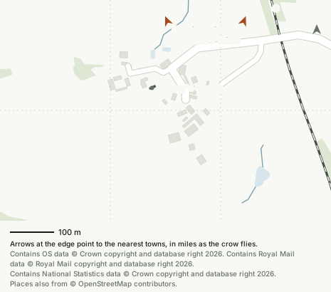
Melbury Bubb street map
The grid squares are 250 metres across.
Yeovil is 6 miles to the north west and Sherborne 7 miles to the north, as the crow flies.
Back to Melbury Bubb (opens in a new tab). Open the map on its own, to zoom in on a phone.
Streets and roads
None of the lanes here has a name in Ordnance Survey's data or OpenStreetMap.
Places
| Place | What | Square |
|---|---|---|
| St Mary's Church | Church | B1 |
Drawn on 17 September 2026 from Ordnance Survey open data, under the Open Government Licence (opens in a new tab), and OpenStreetMap, under the Open Database Licence. Only houses and farms Ordnance Survey names are shown. Something missing or wrong? Email hello@heathfold.uk.
Contains OS data © Crown copyright and database right 2026. Contains Royal Mail data © Royal Mail copyright and database right 2026. Contains National Statistics data © Crown copyright and database right 2026. © OpenStreetMap contributors (opens in a new tab).